Issued by: National Weather Service San Juan, PR
Updated: 4:52 am AST Jul 2, 2025


| Today | Scattered showers, mainly after noon. Partly sunny, with a high near 89. East wind 9 to 16 mph. Chance of precipitation is 40%. |
| Tonight | Showers likely, mainly after midnight. Mostly cloudy, with a low around 77. East southeast wind around 9 mph. Chance of precipitation is 60%. New precipitation amounts between a quarter and half of an inch possible. |
| Thursday | Scattered showers, mainly after noon. Mostly sunny, with a high near 89. East southeast wind 8 to 14 mph. Chance of precipitation is 30%. |
| Thursday Night | Scattered showers, mainly after midnight. Partly cloudy, with a low around 79. East southeast wind 6 to 9 mph. Chance of precipitation is 30%. |
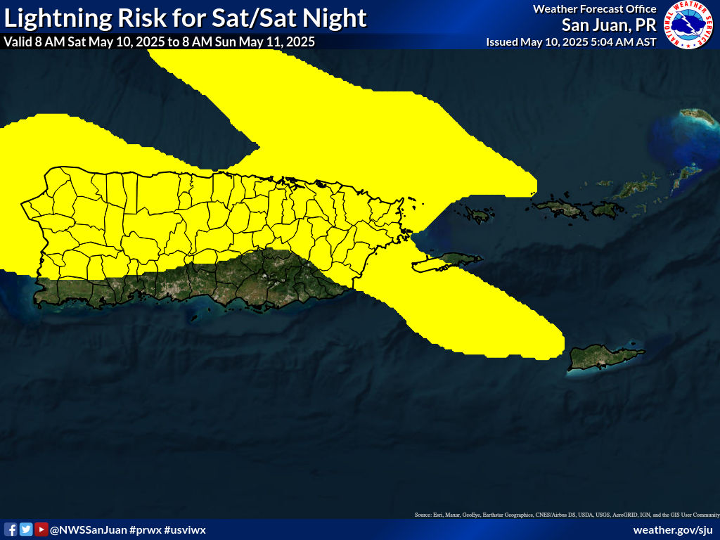
| Independence Day | Scattered showers, then showers likely and possibly a thunderstorm after noon. Mostly cloudy, with a high near 90. East wind 8 to 15 mph, with gusts as high as 20 mph. Chance of precipitation is 60%. |
| Friday Night | Isolated showers. Widespread haze. Partly cloudy, with a low around 78. East wind around 9 mph. Chance of precipitation is 20%. |
| Saturday | Scattered showers, mainly after noon. Widespread haze before noon. Mostly sunny, with a high near 90. East wind 9 to 17 mph, with gusts as high as 22 mph. Chance of precipitation is 30%. |
| Saturday Night | Scattered showers. Partly cloudy, with a low around 79. East southeast wind around 9 mph. Chance of precipitation is 30%. |
| Sunday | Widespread haze. Mostly sunny, with a high near 89. East wind 8 to 15 mph, with gusts as high as 20 mph. |
| Sunday Night | Scattered showers. Partly cloudy, with a low around 78. Chance of precipitation is 30%. |
| Monday | Scattered showers. Mostly sunny, with a high near 87. Chance of precipitation is 30%. |
| Monday Night | Partly cloudy, with a low around 78. |
| Tuesday | Scattered showers. Mostly sunny, with a high near 88. Chance of precipitation is 30%. |
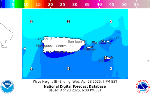
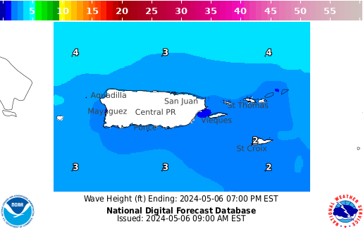
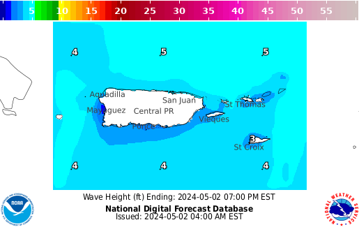
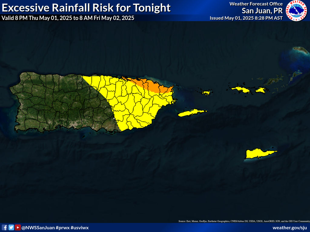
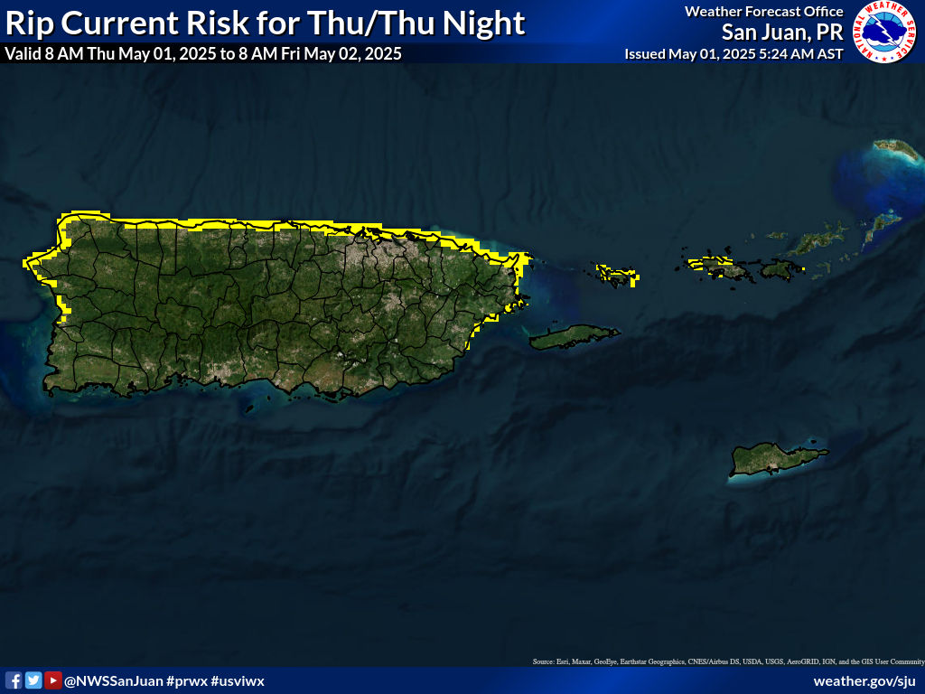
855
FXCA62 TJSJ 020836
AFDSJU

Area Forecast Discussion
National Weather Service San Juan PR
436 AM AST Wed Jul 2 2025

.KEY MESSAGES...

* Passing showers and gusty winds will continue today as small
  patches of clouds continue to move into the region.

* A weak tropical wave is expected on Friday, followed by Saharan
  dust this weekend, resulting in hazy skies.

* Seasonably hot temperatures are anticipated each day, with heat
  indices above 100 degrees in the afternoon hours.

&&

.SHORT TERM...Today through Friday...

A trade wind perturbation promoted variable to showery weather
during the overnight hours. Steered by breezy ESE flow, these
showers left radar estimated accumulations over most of the islands
since midnight. The highest accumulations were north of Yabucoa`s
urban areas with values ranging from 1.20 to locally near 2.00 in.
Lows have ranged from the 60s at higher elevations of Puerto Rico to
the mid 70s and low 80s at lower elevations across the islands.
Current satellite-derived precipitable water (PWAT) values indicate
up to around 1.6 to 1.8 inches over the area, as the perturbation
continues to bring a surge of moisture.

The mid-level ridge that affected us continues to move away to our
west, giving way to a mid-to-upper level low approaching from our
northeast. At the surface, high pressure over the central Atlantic
will continue to promote breezy ESE flow for most of the period.
Patches of moisture and showers with PWAT values of up to around 1.9
inches will continue to be steered towards windward sectors of the
islands today. Due to persistent showers during the overnight hours,
wet roads will be observed as the morning starts, especially at the
eastern region. Afternoon convection is forecast over W-NW Puerto
Rico today and during the period, with lines of showers also
developing downwind of El Yunque and the local islands. After drier
air moves through on Thursday, by late Thursday into early Friday,
peripheral moisture from a tropical wave will once again increase
PWAT values. The tropical wave itself will cross the area later on
Friday, increasing PWAT values to 1.8 to around 2 inches. However,
this wave appears weak and is surrounded by moderate to high amounts
of Saharan Dust, which can serve to further limit it and promote
hazy skies on Friday. Additionally, the bulk of the wave will remain
south of the islands. The increase in moisture should trigger
showers over the islands under the ESE flow, with stronger
convection developing across W-NW Puerto Rico, and downwind of the
islands and El Yunque, in the afternoon. A limited heat threat will
remain across urban and coastal areas during the late morning to
afternoon hours.

.LONG TERM...Saturday through Wednesday...

Surface high pressure over the central Atlantic will maintain
fresh trade winds across the region. At the lower levels, a dense
Saharan Air Layer will move into the islands, resulting in hazy
skies on Saturday and Sunday. Some leftover moisture will also be
available, so some passing showers will continue as well. For the
workweek, not many changes are anticipated, with a trade wind cap
inversion around 850 mb, and all the available moisture trapped
near the surface. A couple of weak tropical wave will move across
the region, but also some patches of light to moderate amounts of
Saharan dust as well. The weather pattern will be variable, with
passing showers over the Virgin Islands and eastern Puerto Rico,
and afternoon convection in western Puerto Rico. No significant or
widespread flooding is expected during the forecast period.
However, it will be hot, with the guidance forecasting heat
indices above 102 degrees for all coastal and urban areas of the
islands each afternoon.


&&

.AVIATION...
(06Z TAFS)

VFR conditions expected to prevail. SHRA will continue to move
through the region, moving at the VCTY of the terminals and over the
terminals themselves, at times. This can cause brief MVFR
conditions. ESE flow up to around 15 to 20 kts with higher gusts
will steer these SHRA and result in afternoon convection mainly over
TJBQ/TJSJ. Winds somewhat decreasing at around 02/22Z.

&&

.MARINE...
Choppy seas are expected to continue across the local Atlantic and
Caribbean waters due persistent moderate to fresh easterly winds.
A weak tropical wave is forecast to move over the local waters on
Friday, increasing shower and thunderstorm chances. Saharan dust will
follow the tropical wave, with hazy skies returning on Saturday and
Sunday.

&&

.BEACH FORECAST...
Moderate to fresh trade winds will maintain a moderate rip current
risk for north and eastern Puerto Rico and for the Virgin Islands
through the end of the week. A low risk is expected this weekend,
before the risk increases again to moderate by early next week.

&&

.SJU WATCHES/WARNINGS/ADVISORIES...
PR...None.
VI...None.
AM...None.
&&

$$

SHORT TERM...MRR
LONG TERM....ERG