Hurricane Season runs from June 1-November 30


[10/10]


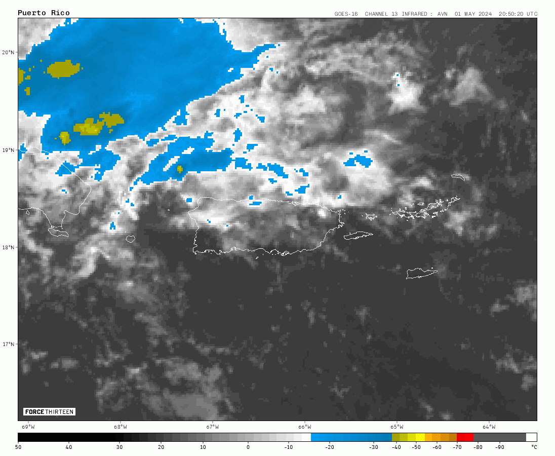
000
FXCA62 TJSJ 260817
AFDSJU

Area Forecast Discussion
National Weather Service San Juan PR
417 AM AST Fri Apr 26 2024

.SYNOPSIS...

Another active day is expected across the local area due to an
approaching mid-to-upper-level trough. Above-normal moisture in
combination with daytime heating and local effects will enhance
the potential for heavy showers and thunderstorms, mainly across
the central interior and western Puerto Rico. There is a limited
to elevated risks of flash flooding, urban and river flooding,
and landslides for the mentioned areas. We encourage citizens to
stay informed and monitor our forecast for additional updates.

&&

.SHORT TERM...Today through Sunday...

Puerto Rico and the U.S. Virgin Islands experienced calm weather
conditions, with a mid-to-upper-level cloud layer moving across
them. Our Doppler Radar detected most rain over the waters, with
some moving mainly across southeast Puerto Rico. Low temperatures
across the coastal areas ranged around the mid-70s and in mountains
and valleys around the mid-60s. The prevailing winds are now more
from the east, though land breeze fluctuations developed overnight.

We anticipated an increase in low-level moisture as the front/shear-
line moves near PR and eventually the USVI. The latest model
guidance suggests an increasing instability trend due to an
approaching mid-to-upper-level trough accompanied by a jet stream.
This weather pattern could lead to deep convective activity,
particularly during the afternoons, when diurnal heating, local
topography, and sea breeze may play an additional role, enhancing
the convection. We strongly encourage citizens to stay informed and
monitor our forecast for further updates, which will empower you to
plan and prepare effectively.

Today, we expect calm weather in the morning, with an increase in
showers and thunderstorms by early this afternoon. The strongest
thunderstorms are possible across the western interior and western
PR. Showers will then increase across the Virgin Islands by late
this afternoon into the evening and early Saturday morning as a
plume of moisture kicks in, resulting in showery weather, with
possible isolated thunderstorms moving inland from the surrounding
waters. Eastern PR may observe unsettled weather conditions from
early Saturday morning to afternoon. Winds will shift from the NE,
shifting the focus of strong afternoon convection across the
southwest quadrant and southern slopes of PR, while moisture may
erode over the Virgin Islands by Saturday afternoon. For that
reason, the risk of flooding remains elevated across most islands,
especially during the afternoons today and Saturday. It`s crucial to
be cautious and aware of these potential risks.

We expect a solid surface high pressure moving off the eastern coast
of the USA, promoting breezy northeast winds across the Northeast
Caribbean around Sunday. This wind flow introduces some
discrepancies in our model guidance regarding the final position of
the plume of moisture. Therefore, our model guidance has moderate to
high uncertainty about how much moisture may pool over the islands
on Sunday if it remains over them or further south across the
Caribbean Sea. Regardless of the discrepancies, unstable and
possibly showery weather remains possible that day.

.LONG TERM...Monday through Friday...

A strong surface high pressure located over the eastern coast of the
United States will promote a northeasterly wind flow from Monday
through Wednesday. As this feature moves from the western to the
central Atlantic winds are expected to veer from a more easterly
component through the rest of the long-term period. Previous model
runs indicated a drying trend for the beginning of the workweek,
however, the latest model guidance now suggests a prolongation of
above-normal moisture across the islands. The precipitable water
content values are between 1.60 to 1.80 until Wednesday, then
increasing up to 2.20 inches through the rest of the period. A vast
moisture field coming from South America to the eastern Caribbean
will help to enhance the shower and thunderstorm activity across the
islands. This wet and unstable weather pattern will promote rainfall
activity everyday across the area, especially over portions along
the Central Cordillera, eastern, and western portions of Puerto
Rico. The U.S. Virgin Islands will also experience moderate to
locally heavy showers by the end of the period. With the expected
weather scenario limited to elevated risks of urban and river
flooding, flash flooding, and landslides will continue to impact
areas already saturated by the previous days/week rainfall activity.
Daytime temperatures are expected to stay in the mid 80s along the
coastal and urban areas of Puerto Rico and the U.S. Virgin Islands,
and from the upper 70s to low 80s across the interior.

&&

.AVIATION...
(06Z TAFs)

Mainly VFR conditions expected to prevail across all terminals.
However, SHRA/TSRA expected to develop over the western interior may
lead to mtn tops obscd and MVFR cigs in and around TJBQ/TJPS btw
26/18z-22z. Also, after 26/23z showers en route from the Leeward
Islands/Atlc waters may cause brief -SHRA or MVFR conds at
TISX/TIST/TJSJ thru the rest of the overnight hours. East winds up
to 12 kt with sea breeze variations aft 26/14z, bcmg ENE around
26/21z across most terminals.

&&

.MARINE...

A small northwesterly swell will continue to spread across the local
waters through today. Showers and thunderstorms will continue to
affect the local waters for the next several days as lingering
moisture from a surface trough/old frontal boundary remains over the
local area. Winds will prevail from the east and becoming northeast
on Saturday under the influence of a surface high pressure moving off
the eastern coast of the United States.

&&

.BEACH FORECAST...

Breaking waves of around 5 feet will maintain the risk of rip
currents moderate for the northern beaches of the local islands.

&&

.SJU WATCHES/WARNINGS/ADVISORIES...
PR...None.
VI...None.
AM...None.
&&

$$

SHORT TERM...CAM
LONG TERM....GRS
AVIATION...DSR


