Hurricane Season runs from June 1-November 30


[10/10]


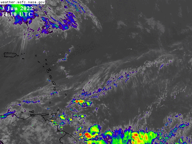
000
FXCA62 TJSJ 241954
AFDSJU

Area Forecast Discussion
National Weather Service San Juan PR
354 PM AST Wed Apr 24 2024

.SYNOPSIS...

The influence of a surface trough will continue to impact the
local weather conditions. Winds are forecast to become light and
easterly tomorrow, promoting slow-moving showers and thunderstorms.
With the expected weather, the potential for urban and stream
flooding remains elevated through the short-term period.

&&

.SHORT TERM...Tonight through Friday...

In the morning, mostly hazy skies prevailed across the islands.
Nonetheless, some shower activity filtered along the northeastern
sections of Puerto Rico, Culebra, and Saint Croix, with the
municipality of Fajardo receiving the heaviest rainfall and
accumulations of around an inch. By the early afternoon hours,
showers started to form along southern, interior, and eastern
sections of Puerto Rico and then spread across the entire island.
This rainfall activity promoted another active afternoon in PR.
Temperatures-wise, they remained in the 80s along the coastal
areas, while over the higher elevations, they stayed in the 70s to
low 80s.

The latest model guidance continues to indicate the presence of the
surface trough near the forecast area. This trough, coupled with
the light east-southeast winds, is persisting and is being
influenced by an approaching frontal boundary from the northwest.
As a result, tonight, we can expect some residual showers of the
afternoon convection across the west, along with overnight passing
showers, particularly over eastern Puerto Rico and the U.S.
Virgin Islands.

On Thursday, winds will gradually become more easterly. As mentioned
in previous discussions, the surface perturbation will gradually
move out of the area from Thursday into Friday. However, a mid-
level short-wave trough, along with the aforementioned frontal
boundary, will cross the northeastern Caribbean through the end of
the week, maintaining or even enhancing unstable conditions
across the region. Moisture levels will also remain above normal
throughout this period. Overall, wet and unstable weather
conditions will prevail for the remainder of the short-term
forecast. In other words, expect periods of heavy showers and
isolated to scattered thunderstorms across Puerto Rico and the
U.S. Virgin Islands. Consequently, the risk of flooding will
remain elevated, with the potential for urban and small stream
flooding, along with localized flash flooding and landslides.
Gusty wind conditions and frequent lightning cannot be ruled out,
particularly with the strongest rainfall activity.

&&

.LONG TERM...Saturday through Wednesday....
//from previous discussion//

Lingering moisture from a surface trough will continue to produce a
pattern of passing showers on Saturday, especially during the
morning hours. By later in the afternoon, this moisture will
gradually be pushed south of the local region, as a surface high
pressure exits the eastern coast of the United States. This surface
high will push drier air into the local area and will promote mainly
fair weather conditions for most of the long-term period. The drier
airmass will lower the precipitable water values to around 1.20
inches from Saturday through Tuesday. Moderate to fresh northeast
winds between 15 to 20 mph with higher gusts are expected in
response to the surface high as well. Despite of the drier air
filtering into the local area, there is the chance for shower
development over the local waters at times. These showers may reach
the U.S. Virgin Islands and portions of Puerto Rico. In addition,
afternoon convection is possible across the southwestern portions
of Puerto Rico each afternoon due to the combination of daytime
heating and local effects. Wednesday will be a transition day from
a dry into a much wetter pattern. A field of moisture is expected
to reach the local area from South America increasing the
potential for heavy showers and thunderstorms across the region.
Daytime temperatures are expected to remain in the mid 80s along
the coastal and urban areas of Puerto Rico and the U.S. Virgin
Islands, and in the low 80s across the higher elevations. Heat
indices will stay in the mid to upper 90s.

&&

.AVIATION...
(18Z TAFs)

Sfc trough across the area will continue to produce SHRA/TSRA across
much of the interior, northern and western sections of PR. This
could lead to tempo MVFR conds at TJBQ/TJSJ thru 22z. Elsewhere, VFR
conditions should prevail for the rest of the period. HZ due to
Saharan dust continues across the northeastern Caribbean but VSBY
should remain P6SM. Low-level winds will continue from the SE at 8-
12 kt, bcmg light and variable overnight. Showers are expected to
increase once again in and around TIST/TISX btw 25/12-16z.

&&

.MARINE...

A small northwesterly swell is expected to arrive later tonight into
Thursday. Showers and thunderstorms will continue to affect the
local waters for the next few days. Another surface trough will
strengthen the easterly winds from Thursday into Friday, before
becoming northeast on Saturday under the influence of a surface high
pressure moving off the eastern coast of the United States.

&&

.BEACH FORECAST...

Breaking waves of around 3 feet will maintain the risk of rip
currents generally low tonight. However, will become moderate
again tonight for the northern beaches of the local islands.

&&

.SJU WATCHES/WARNINGS/ADVISORIES...
PR...None.
VI...None.
AM...None.
&&

$$

SHORT TERM...MMC/LIS
LONG TERM....GRS
AVIATION...DS
MARINE/BEACH FORECAST...MMC
PUBLIC DESK...MMC/LIS/RC